A FEW YEARS after Oregon became a state, some of its leaders participated in what might actually have been the biggest non-Indian-related land-grab swindle in U.S. history.
That’s putting it a bit starkly — it actually was a bit more complicated than just “corrupt officials behaving badly.” But it did result in more than 1.5 million acres of the best Oregon land — land that belonged to all Americans — getting essentially stolen by a few small gangs of well-connected thieves.
It happened a few years after the Civil War. At that time, Oregon was mostly public land, or so the government claimed. But, of course, that “public land” was still in the process of being hijacked from the Indian tribes, which were still fighting to try to hang onto it.
A segment of the Santiam Wagon Road through the lava fields in east Linn County, in the Willamette National Forest, as it appears today. (Image: USFS)
The government had just passed the Homestead Act, giving settlers permission to grab 160-acre hunks of it if they could live on it for five years. But, of course, many of the Indian tribes were not keen to let them do that. ...
So there was obviously a security issue there. Homesteaders wanted military assistance to be able to get to their place easily enough to discourage Indian raids. Plus, they also wanted to be able to bring their crops to market, and the only way to do that was either to pack it out on a mule, or build a wagon road.
With that in mind, a few far-sighted folks had organized companies to provide the infrastructure that they could see would be needed in the not-too-distant future, by building public wagon roads into the interior. They planned to recoup their investment by charging tolls to use them.
But, they were having some trouble making them work out financially. Building roads was, of course, a very capital-intensive process, and there was a limit on how much you could charge people at toll booths to use the road. They might pencil out eventually, but the return on capital investment was pretty low, and maintenance costs could be a real issue.
Ideally, the best solution would have been for the government to do the job, and finance it with some kind of taxation program. But in the wake of the Civil War, the U.S. government was gasping for cash.
So in 1867, the federal government created a subsidy program that paid for wagon road construction with land grants.
The way it worked was, the road company would receive title to three 640-acre (1-square-mile) sections of land for every one mile of road — they got all the odd-numbered sections, three sections deep on each side of the right-of-way. The idea was that it should be able to sell the land to settlers to finance the road.
It may have been a good idea in principle, but in practice the subsidies turned out to be way too large to work as intended.
The idea had been that the opportunity to sell the land would incentivize the road company to do a good job on the road; if they “phoned it in” nobody would want to buy their land, because the access to it would be poor.
But the amount of land the road companies were receiving for their trouble was so large, the companies found it made more sense to bring in investors to complete the road and just take title to the land directly, without needing to offer it for sale at all. That also relieved them of the need to do a good job on the road; in fact, they absolutely did NOT want the road to be good, because when they went to acquire title to the other (even-numbered) 640-acre sections that were not part of the grant, they’d be worth more.
The results, in Central Oregon especially, were some epic swindles.
The first of these didn’t start out as a swindle. It was one of those visionary companies that set out to build a toll road — the Dalles-Boise Road Company, established in 1863.
The company got busy, but soon ran out of money, and for a year or two the road languished in corporation limbo.
But in the meantime, Congress had gotten involved in subsidizing a “military wagon road” from Springfield to Boise, starting in 1865. And it was this road that showed the swindlers how the work was done. The road surveyors, under no requirement to take the most direct route to Boise, let the route meander down through well-watered valleys and other high-value areas, including large segments of the Klamath Indian Reservation.
This was the Oregon Central Military Wagon Road, although in many places it was basically just a footpath. Once the land grants were signed off on and safely in the road company’s hands, most of the road was abandoned.
ONCE THE WAY had been shown, a group of Dalles City businessmen got together and got Congress to set them up with their own Military Wagon Road, and bought out the dormant Dalles-Boise Road Company to do it with. Members of this conspiracy to defraud the federal government included some of Wasco County’s top men — including state Senator Victor Trevitt and Dalles City Mayor James Kelly.
They found a lot of the work was already done for them — they followed Indian trails, “adopted” big sections of already-existing roads, and in other places, basically just blazed a right-of-way to be cleared later.
“The road made many turns in order to lay claim to the best farm land and streams along its route,” historian Lawrence Nielsen writes. “Most of the road construction was done by two horses dragging a log, followed by two men with shovels.”
[EDITOR'S NOTE: In "reader view" some phone browsers truncate the story here, algorithmically "assuming" that the second column is advertising. (Most browsers do not recognize this page as mobile-device-friendly; it is designed to be browsed on any device without reflowing, by taking advantage of the "double-tap-to-zoom" function.) If the story ends here on your device, you may have to exit "reader view" (sometimes labeled "Make This Page Mobile Friendly Mode") to continue reading. We apologize for the inconvenience.]
A wagon crosses the Old Santiam Wagon Road near Sisters, sometime in the late 1800s. (Image: Cascade Volunteers)
The deal was that the land grants would be made to the state of Oregon, which would in turn transfer them to the road company after inspecting its work; Congress thought this would enable the local government to ensure the construction was honest. In practice, though, it just made for a bigger and more well-connected gang of co-conspirators.
Also, clearly they hadn’t thought the matter through — private land generates tax revenue for state and local governments, but federal land does not. Everyone in Salem had a pretty strong incentive to get as much land out of the federal government’s hands as possible, as quickly as possible. So, they did.
So the inspection of the road was a rubber-stamp formality. The land grab was duly approved, and the conspirators were given 592,558 acres of the best land Central Oregon had to offer. It was subsequently sold to an investor and became the Eastern Oregon Land Co.
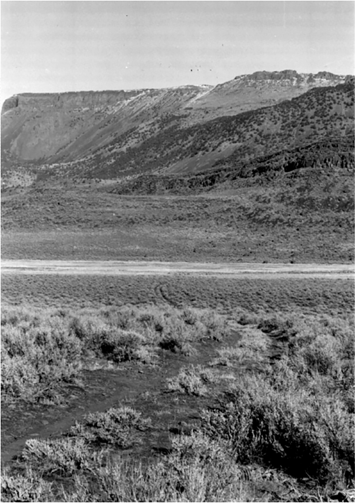
The tracks of the Oregon Central Military Road in Lake County, with Hart Mountain in the background. (Image: Bureau of Land Management)
The biggest wagon-road scam, though, was the Willamette Valley and Cascade Mountain Military Wagon Road, which left Albany and followed more or less what today is Highway 20.
Like the Dalles-Boise road, this one started out as a real, unsubsidized wagon road — the part that later became known as the Old Santiam Wagon Road, from Albany through Sweet Home and on to Sisters. Construction started in 1864, and a company of soldiers actually helped finish the Santiam section. The soldiers were traveling on the road to Fort Polk, near Sisters, but they caught up with the construction crew short of the fort and pitched in to help finish it.
The military-wagon-road legislation land grant reached the Santiam Wagon Road backers just in time, as they also had run into financial difficulties by 1867; but after that, they transitioned smoothly from a real road building outfit into a free-land scammer, pushing through Central Oregon at a furious pace with no intention of the road ever being used, just to grab that free government land.
Even the western part of the Santiam Wagon Road could be pretty sketchy. Historian David Braly reports that part of the path through the Cascades was less than seven feet wide, and with stumps in the right-of-way up to a foot high; it could only be crossed during a few summer months.
But the Santiam Wagon Road, from Albany through to Sisters, quickly became a very important route. For a good 75 years it was the primary road linking the Willamette Valley with Central Oregon.
The part east of the Cascades, though, was basically a string of trail markers blazed through the richest and most well-watered areas the builders could find, except for a long stretch of the Steens Trail which they simply appropriated. On many days the crews “built” 15 miles of road, presumably by walking along and driving stakes into the ground every hundred feet or so to mark the way.
In total, the company got 861,512 acres of free land for their trouble, and ended up not only with that but with the right to charge tolls on the Santiam River portion that was actually being used. Everything east of the Cascades was abandoned as soon as the land grants were made.
And about those land grants ... some of them weren’t actually the government’s to give. Particularly in the Prineville area, much of the land the company claimed had already been settled, and the ranchers and homesteaders who had built homes and barns and other improvements on it were furious.
Led by Elisha Barnes, the mayor of Prineville, they fought a legal battle to get the land grants overturned. But the battle dragged on into the 1880s, and by then the lands had been sold and resold to innocent third parties and investors. Finally, in 1893, the U.S Supreme Court ruled that the grants were valid, and the settlers had to either leave the farms they’d spent decades developing, or become tenants on their own property.
If they’d had a little more self-awareness, those settlers might have wondered if this was how the Indians they’d displaced when they set up their homesteads had felt!
“It is considered one of the most brilliant fakes ever perpetrated on the American public,” wrote historian F.A. Shaver in 1905, and President Grover Cleveland called the grants “unblushing frauds.” But the Supreme Court ruled they were legit, and everyone had to just give it up and move on.
On a side note, the Santiam Wagon Road was still in use as a toll road well into the 1920s. In 1905, a pair of curved-dash Oldsmobile cars passed over it, on their way to the Lewis and Clark Centennial Exposition in Portland; they were Old Scout and Old Steady, two identical horseless carriages that had been driven all the way over from New York in the first transcontinental automobile race. The toll collector didn’t know what to charge for them, but he decided that since they kind of sounded like hogs, he'd charge the drivers the toll rate for hogs.
(Sources: Pioneer Roads in Central Oregon, a book by Lawrence E. Nielsen & al. published in 1985 by Maverick Publications; Crooked River Country, a book by David Braly published in 2007 by WSU Press; Santiam Wagon Road exhibition at cascadevols.org)
Background image is a hand-tinted photo of the bridge across the Umpqua River at Reedsport designed by Conde McCullough. The green arch in the middle is the painted steel swing section of the bridge. Here is a link to the Offbeat Oregon column about this.
Scroll sideways to move the article aside for a better view.
Looking for more?
On our Sortable Master Directory you can search by keywords, locations, or historical timeframes. Hover your mouse over the headlines to read the first few paragraphs (or a summary of the story) in a pop-up box.